")
Route length: 11,3 km
Duration: 6,5 hours
Ascent: 1.609 meters Descent: 114 meters
Route description: Ascent-Difficulty: Very difficult
Recommended to: all mountaineering clubs and individuals with certain experience in mountain trails
Season: May to October, but also during winter if you are experienced in winter mountaineering
* The information above is given to reach your destination.
One of the most beautiful and challenging routes of Olympus. It gives the impression that you are on a plane, as you can see the beaches of Pieria and the Pierian mountains from above. The more you ascend the more astonishing the view becomes. Every step is breathtaking. The route is quite large and the increasing levels of Olympus are tiring. That’s why you can divided the route in parts; half the way of the route you pass by the Petrostrougkas refuge, where you can stop to rest and refill your energy. Later, you can stop again at the Skourta summit, where you can see for the first time the summits and the "Plateau of Muses". A few moments later and with a little more effort, you will reach your destination, Giosos Apostolidis and Christos Kakkalos refuges.
The translation in English was made by " Sidiropoulou Athina " and we thank her, for her help.
General Informations:
It is a route of 11,3 km total length, all on path, with altitudinal slope (ascent) of 1.609 meters. The duration of the trail is 6,5 hours. There are no signs through the trail but the path is very distinct while at crossroads there are signs which inform you where each path leads and which you should follow to reach your destination. Throughout the path there is no mobile service. In general, it is described as a difficult route and can be crossed by people with certain experience in mountaineering.
USEFUL PHONE NUMBERS:
-European Emergency Number: 112
-Fire Brigade: 199
-E.K.A.V. (Ambulance Help): 166
-Petrostrougkas refuge: +302351200766
-Giosos Apostolidis refuge: +302351082840
-Chr. Kakkalos refuge: +306937361889
All the above are summarized in the following chart:
Click on the word “wikiloc” so you can store the route on a Garmin gps device or Androit or Smartphone device. You can also print the information without the illustrations shown below. The tracking of the trail was done using a 650t Montana gps device by Garmin.
The route is also recommended by:
- Petrostrougkas refuge: +30 23512 00766/+30 6977 246 350 Nektarios/+30 6948 821 513 Telemachus
- Giosos Apostolidis refuge: +30 23510 82840/+30 6939 777 064 Tsavdaris Nikos/ +306948 043 655 Mpotelis Lazaros
- Christos Kakkalos refuge: +30 6937 361 689 Styllas Michalis
- Sakis Prokovas taxi driver: +30 6937 176 867
In particular:
Starting from Litochoro in Pieria, follow the signs and after 14 km you will arrive at a crossroad with a slightly ascending road at the location “Gkortsia”. This place is also known as “Crossroad”, you can park your car here and start walking towards the Plateau of Muses at an altitude of 1.110m (Image 1)…
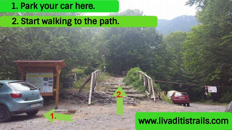 Image 1.
You shouldn’t feel discouraged by the many kilometers and the large slope. Have in mind happy thoughts and stay alert all time to admire the pictures the trail and this Godly mountain have to offer. After 2 km, in about 50 minutes and at an altitude of 1.450 meters, you will arrive at the location “Mparmpa”, where you can find a bench with amazing view. Continue left on the path (Image 2)…
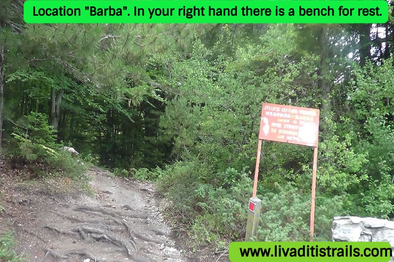 Image 2.
Walk for 2,8 more kilometers to reach a crossroad (the sign on the tree informs you, too) which points two ways: the path on the left for the “Cave of Ithakisios” and the path straight ahead (on the right) just after the tree, there is a water tank alongside the path (Image 3)…
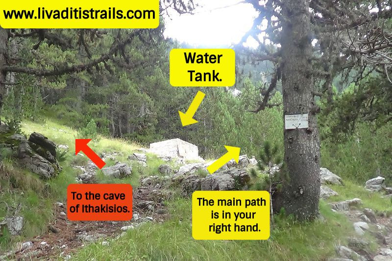 Image 3.
After the crossroad, there are 500 meters remaining to reach Petrostrougkas refuge, where you can rest having a cup of coffee or eating a snack. You are at 1.945 meters of altitude and you have walked from Gkortsia (where you parked your car) 4,8 km in about 2,5 hours (Image 4)…
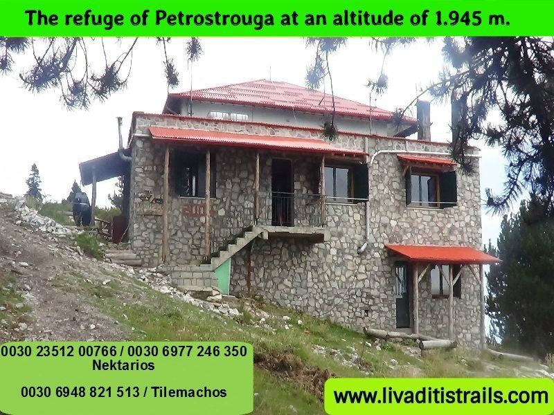 Image 4.
After getting some rest, continue on the ascending path to arrive at your destination. There is also the chance that carriers with their animals overtake you. They are considered the soul of the mountain as they take care of the daily supplementation of the refuges, for them to provide all comforts to visitors and climbers who cross the mountain (Image 5)…
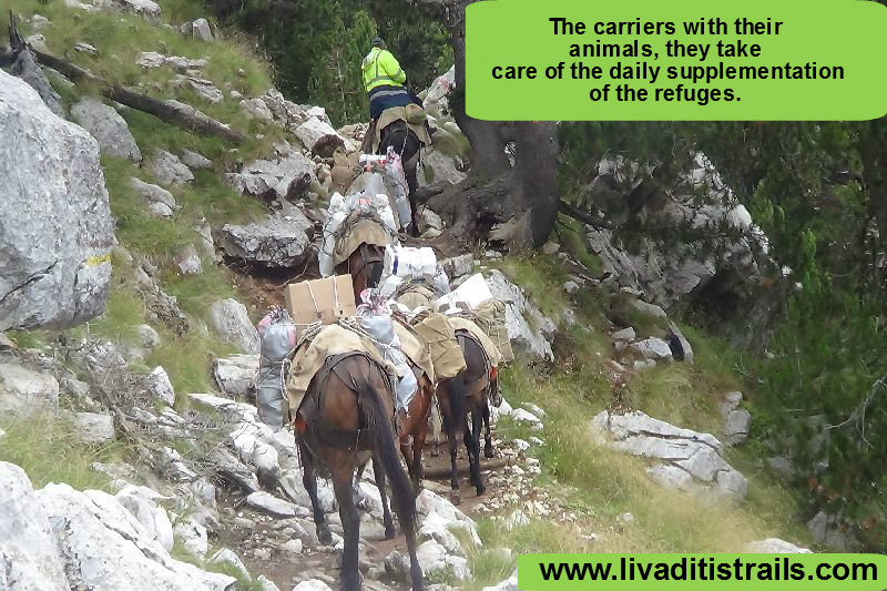 Image 5.
After the refuge, the vegetation is sparse. Until you reach the refuge you walk through a forest path, but later the scenery becomes more alpine (Image 6)…
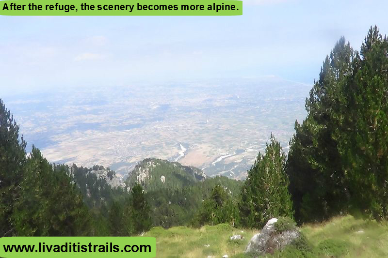 Image 6.
The route is increasingly ascending from each hillside to the next, the curvy path isn’t very tiring as you get closer to your destination (Image 7)…
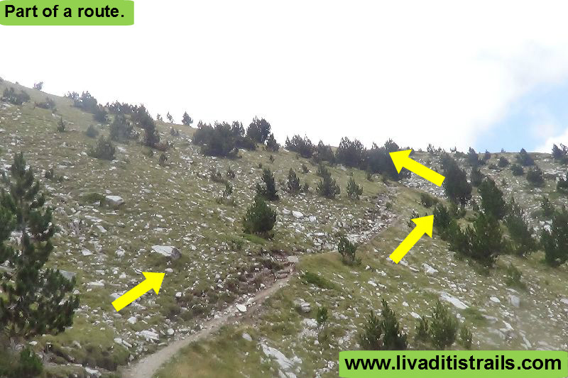 Image 7.
The more you ascend the more you feel like being on a plane, at the rear you can see the beaches of Pieria and in front of you, on your right the Pierian Mountains (Image 8)…
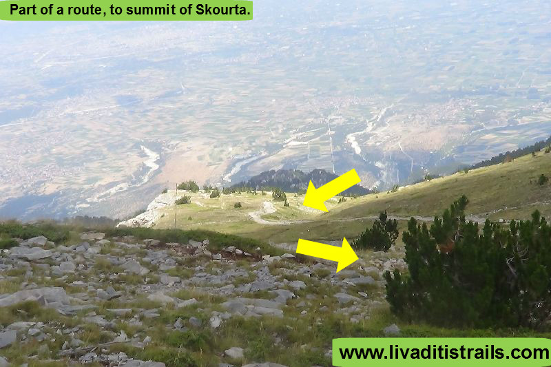 Image 8.
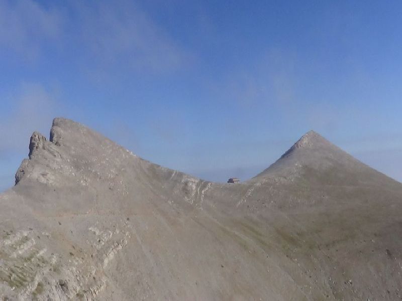
Finally, from afar, you will notice a landmark on a hill. It’s Skourta summit at an altitude of 2.476 meters (Image 9)…
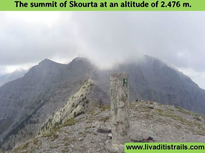 Image 9.
In front of you emerge the summits and the Plateau of Muses, on your right the Pierian Mountains and at your rear the sea. Up until this point, you have walked 7,9 km in total, from where you parked your car, in about 4 hours and 45 minutes at an altitude of 2.485 meters (Image 10)…
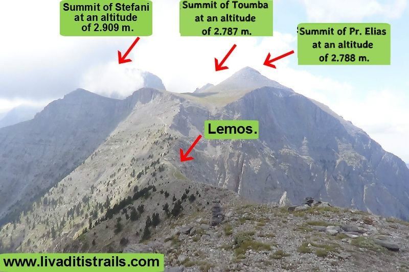 Image 10.
From your standing point, you can notice how the path continues next until the “Passage of Giosos”, which leads to the “Plateau of Muses” (Image 11)…
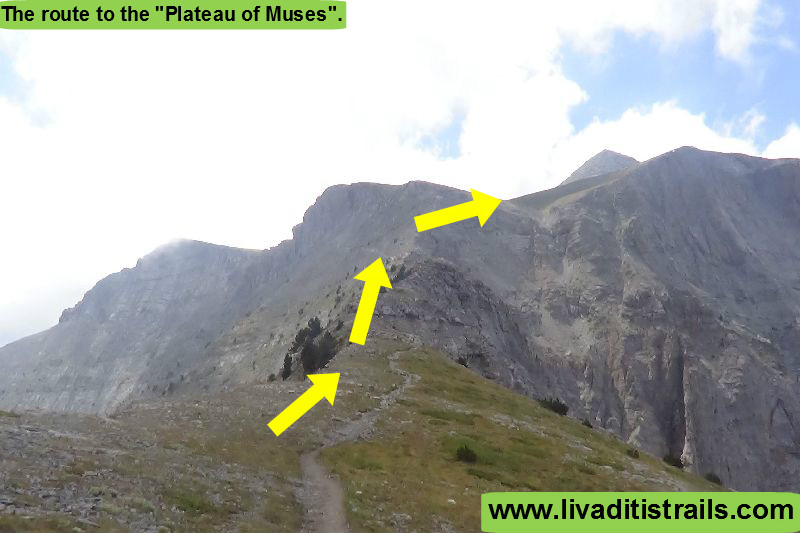 Image 11.
Since you have figured out the rest of your way and sat back for a moment, continue to your next goal, the “Passage of Giosos”. Taking a glimpse at your rear, the trail you have crossed this far looks like this (Image 12)…
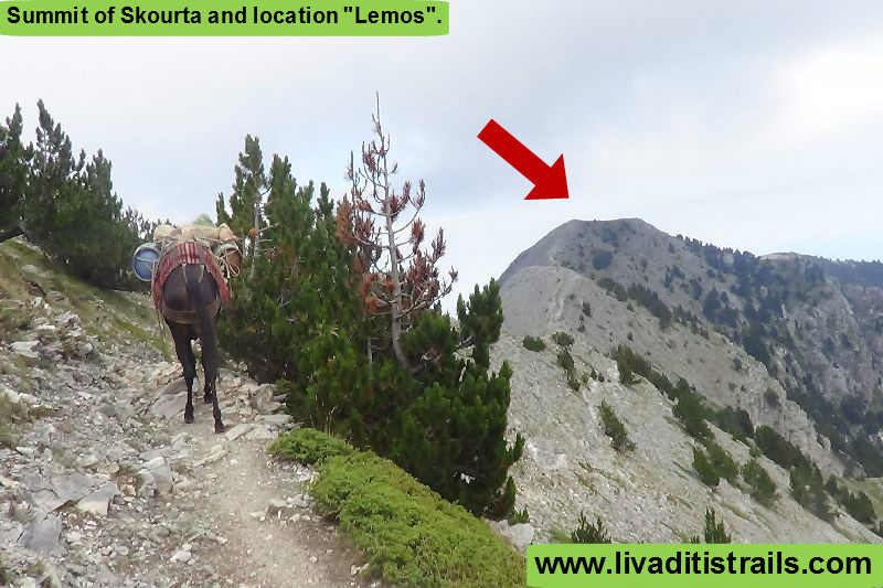 Image 12.
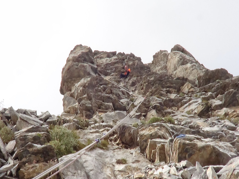
From the “Skourta” summit until the “Passage of Giosos” you will be walking for another 1,4 km in about 1 hour at an altitude of 2.550 meters. Grab the wire rope, when you see it, and move carefully and slowly upwards (Image 13)…
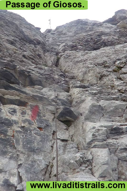 Image 13.
The first thing to see at the plateau is a sign: go left for Ch. Kakkalos refuge and go right for Giosos Apostolidis refuge (Image 14)…
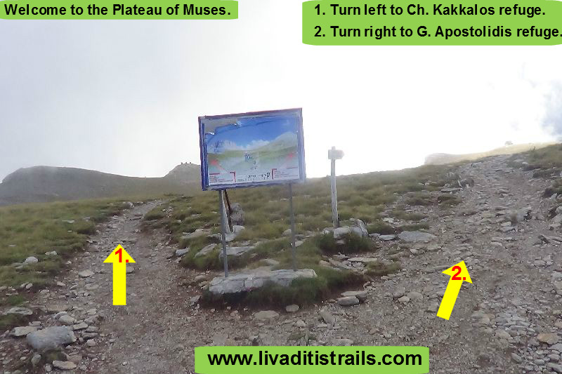 Image 14.
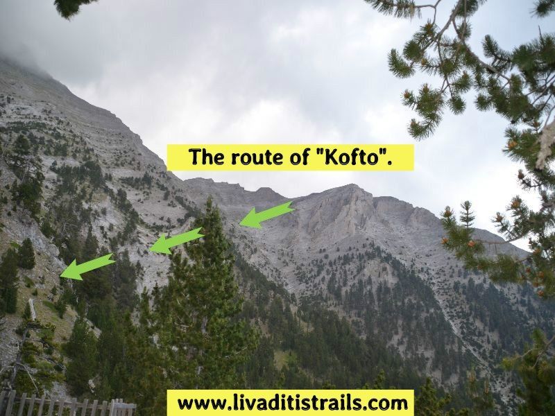
The trail from the “Skourta” summit to the plateau looks like this. The photo was taken from Profitis Elias (Image 15)…
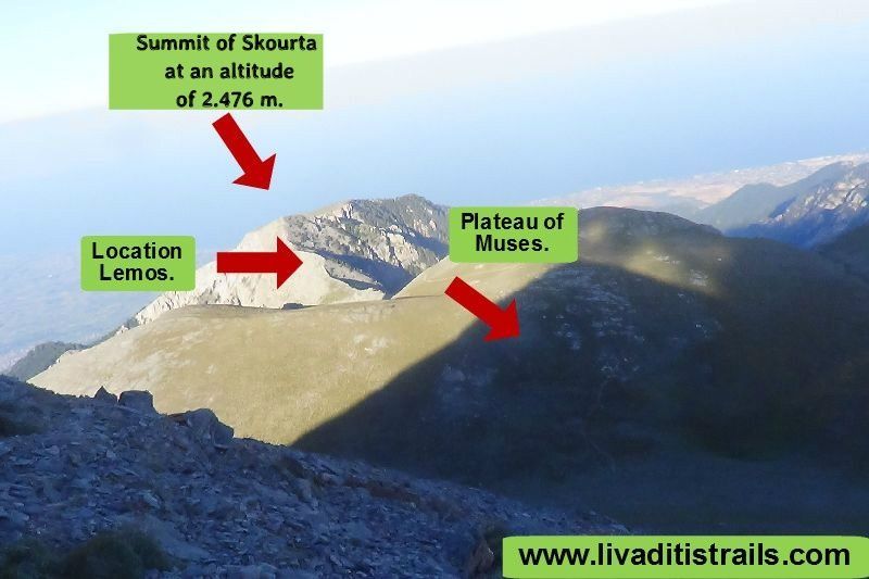 Image 15.
We recommend you go right to cross the whole plateau and realize the beauty and the holiness of the landscape (it’s only a 10 minute detour) and arrive first at Giosos Apostolidis refuge (Image 16)…
 Image 16.
Next, follow the path starting from the refuge and which leads to Christos Kakkalos refuge where your route ends. Although, the finish point is defined by your reservations to spend the night (Image 17)…
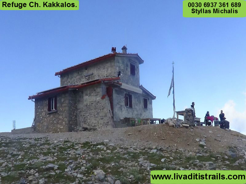 Image 17.
Totally, you have walked 11,3 km in about 6,5 hours with a slow pace and you have ascended from “Gkortsia”. You will definitely feel compensated by the trail. All the paths of Olympus are GODLY. Make up your mind and find your place in the Pantheon among Gods.
The passage of the trail occurred on Friday 26th August 2016 alongside with the friend and co-mountaineer Kyriakos Ioannidis the same day we gathered all the information that was mentioned, as well as the photographs included in the narrative of the path. We consider ourselves responsible, so we would like to treat those who love Nature and hiking and enjoy learning about new places with the same responsibility. We would also like, if you cross the trail above or any other on our website, to contact us (e-mail: This email address is being protected from spambots. You need JavaScript enabled to view it.) whether we were accurate on our description or there was a flaw that should be corrected.
Thank you for your trust and for visiting our website.