")
Route length: 19,5 km
Duration: 10 hours
Altitudinal slope: Ascent: 888 meters - Descent: 888 meters
Route description: Circular-Difficult.
Recommended to: All mountaineering clubs or individuals with great experience in mountain trails.
Season: All year around.
A route that starts from the mountainous “Pahni” settlement and leads to the mountain range of Rhodope, very close to the Hellenic-Bulgarian boarders. It offers an amazing view of the Pomak Villages and a fresh point of view on an underestimated area especially by mountaineers, because even if it has wonderful paths and summits, it is not very known to the majority of climbers.
General Informations:
It is a circular route of 19,5 km total length - more specifically 7,2 km of dirt road and the rest 12,3 km of path. The duration of the trail is 10 hours. The signs are very sparse and the marks are almost faded, so you need to be very careful to locate and follow these signs. You should be extremely cautious about two things: the first is that while there are many springs throughout the trail, water flows only during months with heavy rains, so if you decide to walk through the trail in the summer you should pack enough water for you to go and return from your destination. The second is that while returning next to the stream you should be careful of the big slope of the hillsides which you will pass to go back to the settlement of Pahni.
USEFUL PHONE NUMBERS:
European Emergency Number: 112
Fire Brigade: 199
E.K.A.V. (Ambulance Help): 166
Health Center of Echinos: +30 2544022120
All the above are summarized in the following chart:
Click on the word “wikiloc” so you can store the route on a Garmin gps device or Androit or Smartphone device. You can also print the information without the illustrations shown below. The tracking of the trail was done using a 650t Montana gps device by Garmin.
The translation in English was made by " Sidiropoulou Athina " and we thank her, for her help.
In Particular:
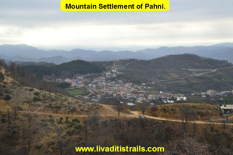
Starting from Xanthi follow the old Xanthi-Drama Highway (the road that leads to Stavroupoli). At the 8 th km there is a junction on your right hand that leads to Sminthi, Echinos and other villages, turn right. After 5 km and 300 meters you meet the Town Hall of Municipality of Myki, which is located at the settlement of Sminthi. You continue your road to Echinos and after 4 km you reach a crossroad that informs you need to drive another 4 km to Glafki and another 6 for the mountain settlement of Pahni, where is your final destination. So, you have drove 27 km from Xanthi in about 40-45 minutes to reach the starting point of today’s adventure, which is the town square of the settlement of Pahni, as we already mentioned, at an altitude of 760 meters. Are you ready? Let;s begin (Picture 1)...
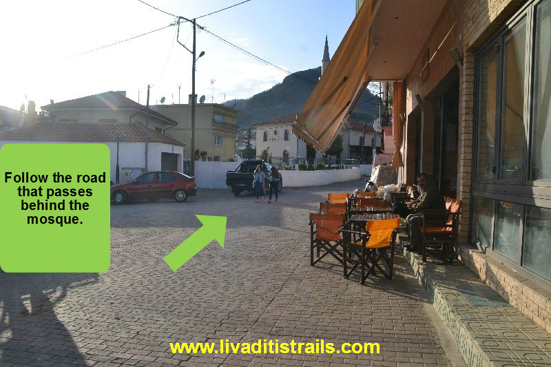 Picture 1.
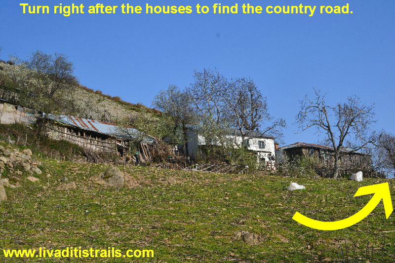
At the center of the village you can park your car and then follow the road that passes behind the mosque and leads outside of the village. After walking for 1 km and 200 meters you reach a crossroad of 3 roads. You follow the concrete road in the middle (Picture 2)...
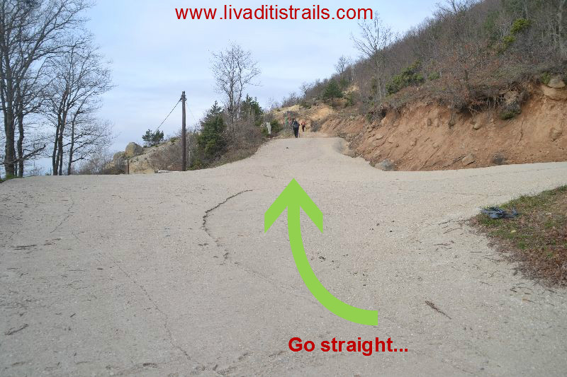 Picture 2.
You continue walking on the country road for another 300 meters when you arrive to a crossroad with a water fountain at an altitude of 850 meters. Follow the right country road. From the start until this point you probably need about 20 minutes (Picture 3)...
 Picture 3.
Continue on the country road for another 700 meters and you will see on your left a water fountain with potable flowing water, where the path starts at an altitude of 890 meters (Picture 4)...
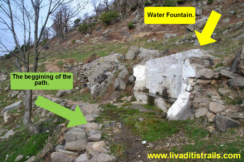 Picture 4.
The trail for the next 2 km is of mild slope, so you have the chance to look around and to enjoy the surrounding and the beauties it offers (Picture 5)...
 Picture 5.
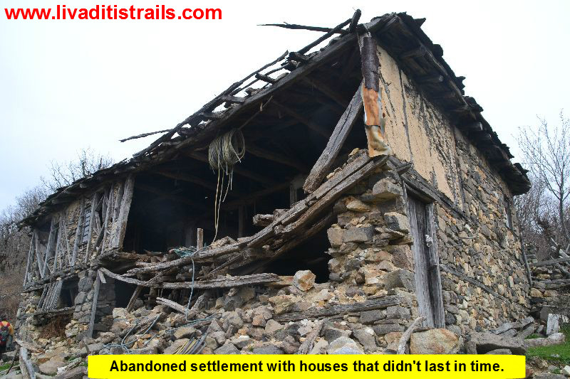
Along the route you can admire the old way of house construction, since you walk through abandoned settlements with houses that didn’t last in time (Picture 6)...
 Picture 6.
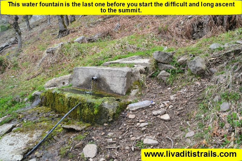
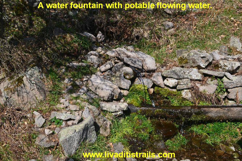
As was mentioned before, since you start on the path and for the next 2,2 km you can admire the beauty of the area. At a certain point and after walking for about 55 minutes on the path, you come across a water fountain with potable flowing water at an altitude of 970 meters. Be careful about the water fountain because it is the last one before you start the difficult and long ascent to the summit and you won’t find one any time sooner than hours later after you have covered half the route for descending (Picture 7)...
 Picture 7.
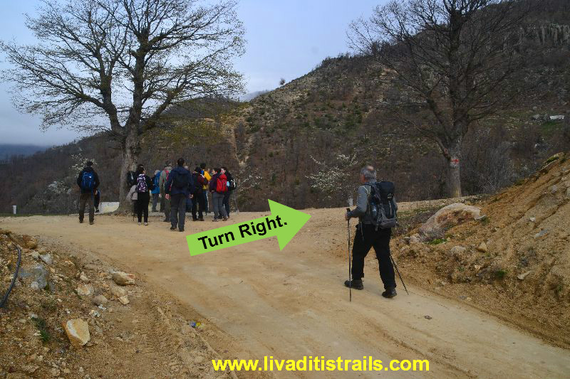
From the fountain you will have to climb the hillside right above and follow the route on the ridge. At this point, we should mention that there are red signs on the trees, but they are barely distinguishable and far from each other so you need to be careful to notice them and always check the given route on your gps device or your mobile through the wikiloc page. Continue on the ridge which is followed by a hill at its end. When you climb the hill you can see from far the desirable summit (Picture 8)...
 Picture 8.
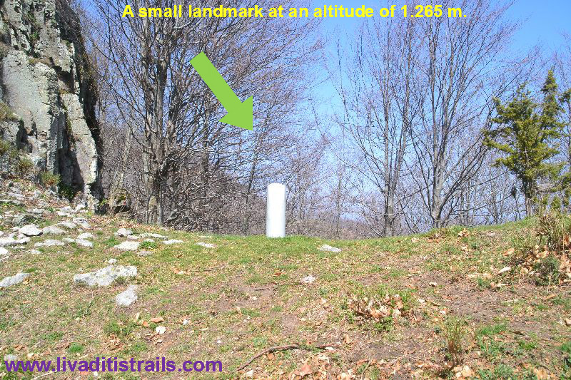
You start climbing one by one the hills that you face in front of you. Sometime later you will see a structure made by concrete like a small landmark at an altitude of 1.265 meters, which indicates that you are on the right path. From the water fountain to this point you have walked 3,8 km more in about 2,5 hours (Picture 9)...
 Picture 9.
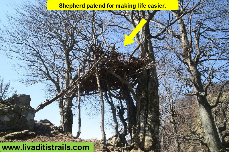
Along the trail you will also have the chance to admire the shepherds patents to make their lives easier for the pasture during summer (Picture 10)...
 Picture 10.
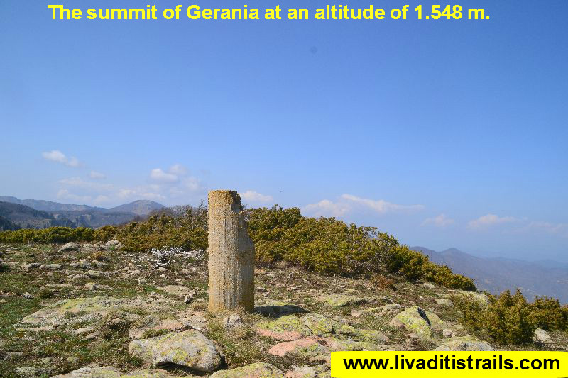
Between the small column and the top lay 1,8 km for which you need to walk about 1 hour and 10 minutes. The joy of reaching the top is incomparable and for this one is even bigger because you started from an altitude of 760 meters and reached an altitude of 1.548 meters. To achieve this you needed 5 hours and 20 minutes and you walked precisely 10 km to reach today's desirable goal (Picture 11)...
 Picture 11.
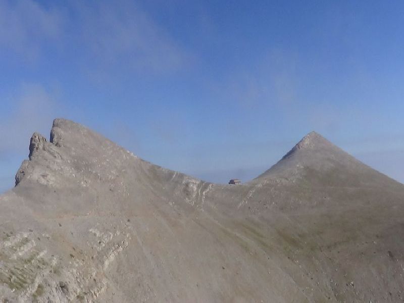
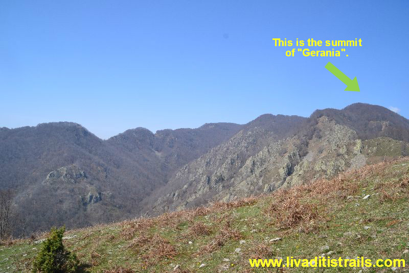
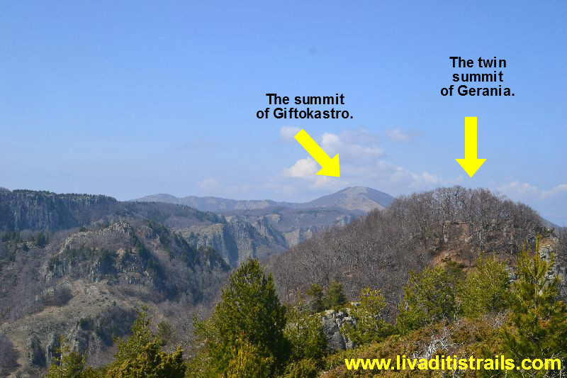
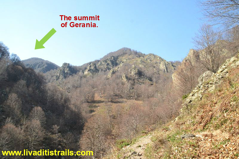
The view from this height is incomparable. You can admire, apart from other summits, the favourite summit of Xanthi District, “Gyftokastro” and also its twin summit “Gerania” (Picture 12)...
 Picture 12.
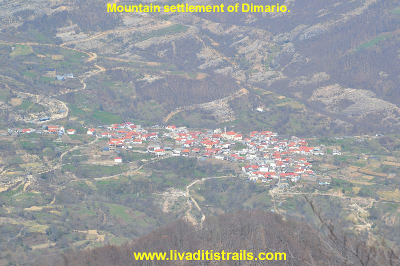
As well as villages in the area, like Dimario (Picture 13)...
 Picture 13.
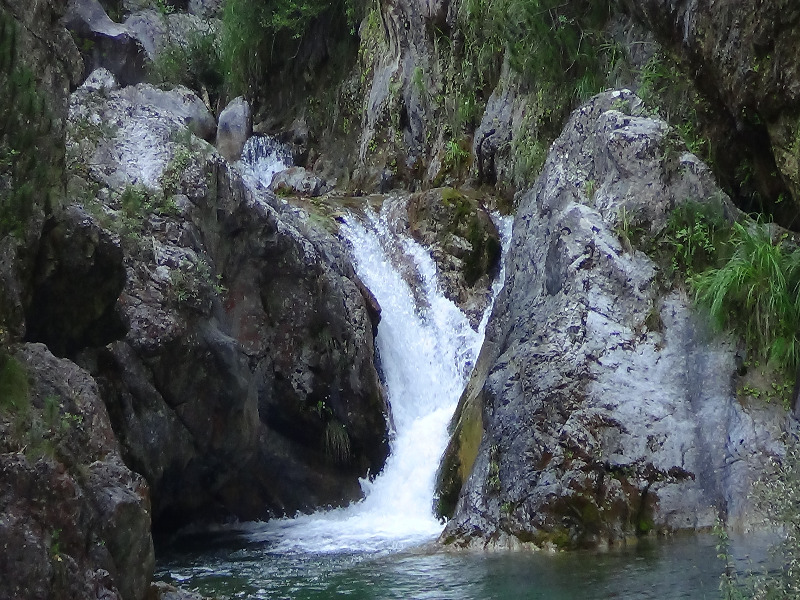
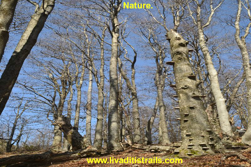
After getting some rest, it;s time to return. You can return through the same route you came, if you like, in case it seems safer, otherwise you can go back through the trail we recommend. Follow the signs that lead you left from the landmark (having Gyftokastro in front of you). You descend the hillside until you hear and then see the stream in the canyon. You can admire another one of Nature's works (Picture 14)...
 Picture 14.
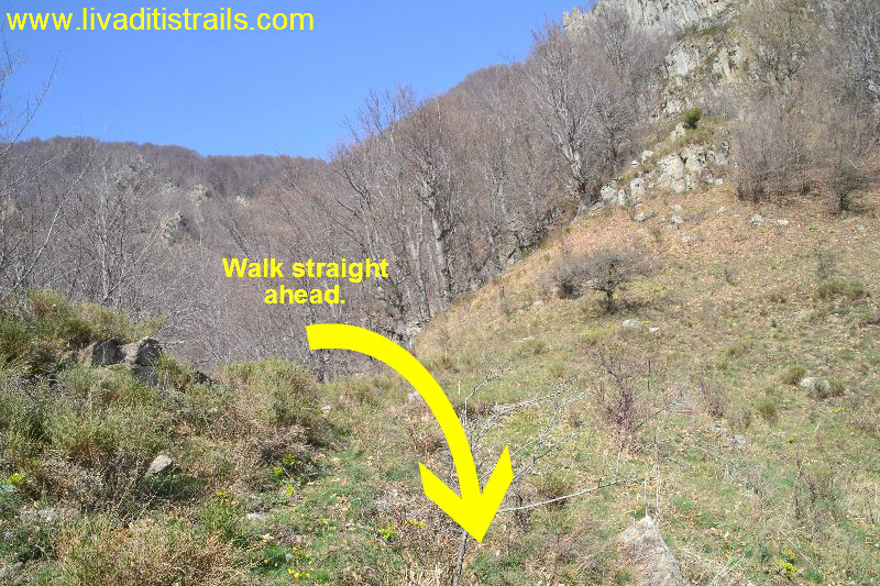
You need to be careful of the steep downward slope of the hillsides you will descend to follow the stream. For the next 1,5 km you must also be alert to track and notice the signs and to descend safely (without any injuries). It will probably take you about 50 minutes to go through this dangerous spot. At a certain point, the signs stop, however you continue walking straight ahead. Besides, at some point you will start seeing meadows and shepherd farms of the area. This is where you must go to reach the country road that will take you back to the settlement of Pahni (Picture 15)...
 Picture 15.
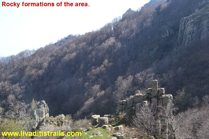
Taking a look at your rear you can see the amazing rocky formations of the area (Picture 16)...
 Picture 16.
...and where you have been a few hours ago (Picture 17)...
 Picture 17.
As was mentioned earlier, you will find flowing water while descending from the summit. Indeed, the first water hoses, prepared by the shepherd to water their animals, can be found 1,5 hours after descending from the summit and after walking 2 more km, 12 km in total at an altitude of 1.090 meters (Picture 18)...
 Picture 18.
From the last spring, you need another 2,5 km to reach the country road and about 1 hour to arrive at a farm at an altitude of 895 meters, after which starts the country road for your return (Picture 19)...
 Picture 19.
As long as you get on the country road, there are 5 km remaining to arrive again at the mountain settlement of Pahni that is about 1 hour and 10 minutes. After returning safely to where you have parked your cars and as to realise and understand the importance and the difficulty of the route, it is imposed to visit one of the restaurants in the area, either at “Kotani” or at Sminthi or Thermes, to replenish your energy and to exchange thoughts. After all we believe you deserve to break away a little from your food habits.
The passage of the trail occurred on Sunday 3rd April 2016 alongside with the Mountaineering Club of Xanthi and the Mountaineering Group of Alexandroupoli and the same day we gathered all the information that was mentioned , as well as the photographs included in the narrative of the path. We consider ourselves responsible, so we would like to treat those who love Nature and hiking and enjoy learning about new places with the same responsibility. We would also like, if you cross the trail above or any other on our website, to contact us (e-mail: This email address is being protected from spambots. You need JavaScript enabled to view it.) whether we were accurate on our description or there was a flaw that should be corrected.
Thank you for your trust and for visiting our website.