
")
Length: 7 km and 500 meters.
Duration: 2 hour 30 minutes.
Altitudinal slope: Ascent: 318 meters. Descent: 318 meters
Route rating: Ascent - Average degree of Difficulty.
Recommended: In all mountaineering clubs, as well as those with some experience in climbing mountains.
Season: All year round, provided there are no snowfalls.
* The information listed above is just to go.
It is another beautiful route that Nature offers us generously in the area of Livaditi. Sweat it out a bit more, carry with you some coffee and come at the most beautiful cafe that exists…
The translation in English was made by "Fytopoulou Sofia" and we thank her, for her help.
General Information:
It is a circular path of total length 7.5 km and more particularly, 4 km on a path and 3.5 km path on a rural road with 292 altitudinal gradient (uphill) meters. The duration is 1 hour on the rural road and 1 hour and 30 minutes on the trail. During the trail you will see over the trees white and red marks, while on difficult points, in which you need to be careful, there are marking tapes. Along the path there is no signal for any of the phone companies, just on the summit. Generally, it is classified as a medium difficulty route and can be performed by children aged over 10 years old.
USEFUL PHONE NUMBERS:
- European emergency number: 112
- Fire Brigade: 199
- E.K.A.V. : 166 (Ambulance Help)
- Health Centre of Stavroupoli: 25423-50000
All the above are summarized in the following chart:
Click on the word "Wikiloc" so you can store the route on a Garmin gps device or Androit or Smartphone device. You can also print the information without the illustrations shown below. The tracking of the trail was done using a 650t Montana gps device by Garmin
In particular:
Starting from the city of Xanthi, you could follow the road to the small town of Stavroupoli and then after passing the villages of Dafnona and Ano Karyofito you end up, after a distance of 48 km in the mountain village of Livaditi at an altitude of 1,250 meters. While you are on your way to Stavroupoli and more specifically at the height of Lykodromio at an altitude of 285 meters, you will notice that there is a right junction, which ends up in the village of Livaditi through Kallithea. It is advisable to avoid this route during the months of November to April, because due to frequent snowfalls the route closes and it is difficult to get to your destination (this road is of minor importance and during the winter season snow removal equipment is not available). Also, there is no telephone signal all the way, just on a few points. This particular route is far more pleasant to be followed during the other months, from May to October (Picture 1).
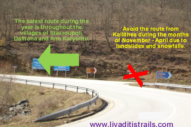 Picture 1.
Livaditis is the highest mountain village of Xanthi with only 8 residents (Picture 2).
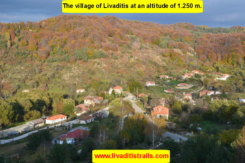 Picture 2.
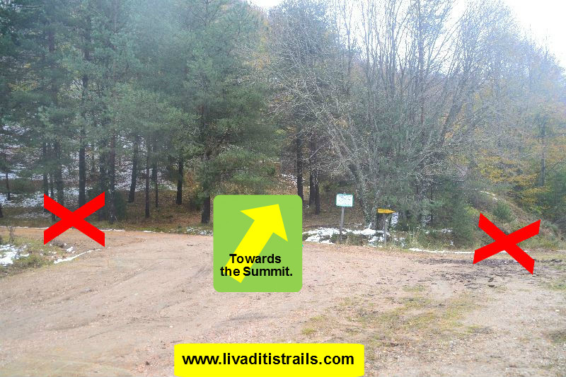
Right after Livaditi (8 km), you will arrive at the Erymanthos Forest Village (altitude 1.315m.).There, the asphalt road ends and a cluster of rural roads begins, where each one has a different destination. Therefore, you start walking on the first street on your right hand (Picture 3).
 Picture 3.
At about 500 meters and at an altitude of 1350 meters, you will come across an intersection on your left hand. Follow the road uphill (Picture 4).
 Picture 4.
So, follow the path there (at the beginning you will pass a tank) and after walking 1,400 meters and at an altitude of 1.485m.(after 25 minutes), the trail opens into a new dirt road. The entire route is in a beech forest; during the summer it’s cool and during the autumn and winter months there is dense foliage on the trail. Once you reach the road, turn left and walk for another 300 meters, for about 5 minutes. (Picture 5).
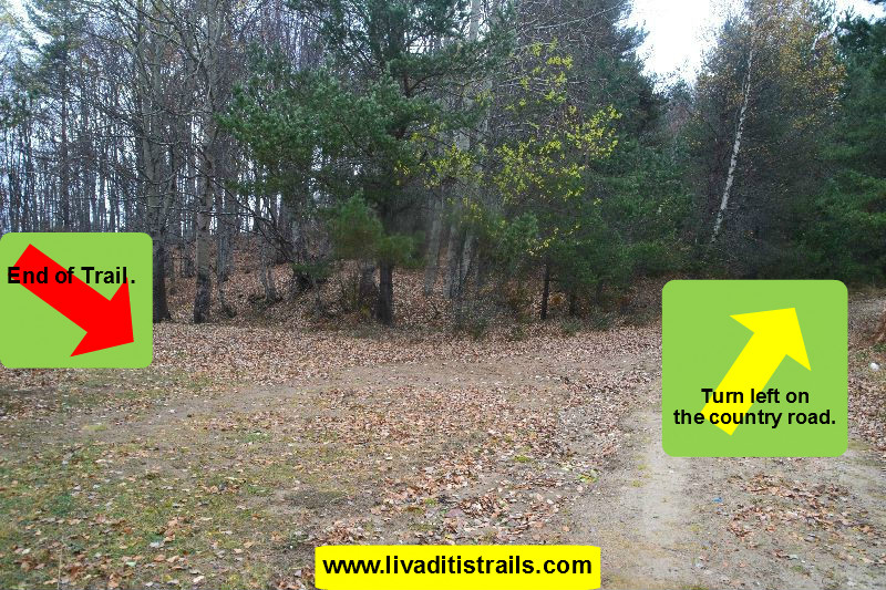 Picture 5.
You will see in front of you a lowered bar and in the depths of the forest there are the old facilities of a military camp with a chapel on your left, at an altitude of 1,500 meters. On your right hand you will see a kiosk, behind which the path to the top begins (Picture 6).
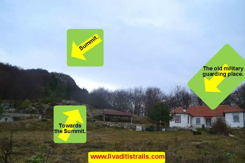 Picture 6.
After 100 meters you will see an arrow on a tree that informs you to keep going on your left hand, following the normal path. If you follow the right side, it also leads you to the top, but it is steeper and thus more tiring. After 700 meters (25 minutes walking) you will reach the top. The last 200 meters (5 minutes) are similar with the steep path. You have then achieved your goal, after 1 hour and 20 minutes, and you can see the guarding place that is on the top. If you are looking for the vantage point, you can find it just above the observation post of the guarding place, which is located at an altitude of 1,617 meters (Picture 7).
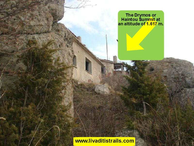 Picture 7.
However, the time to return has arrived and needs lots of attention. When you approach the guarding place of the top, you will find out that from the left side of the building, there is a ditch which was dug (like a trench) and from there marathon signs called "Haintou" begin, as well as marking tapes onto trees (Picture 8).
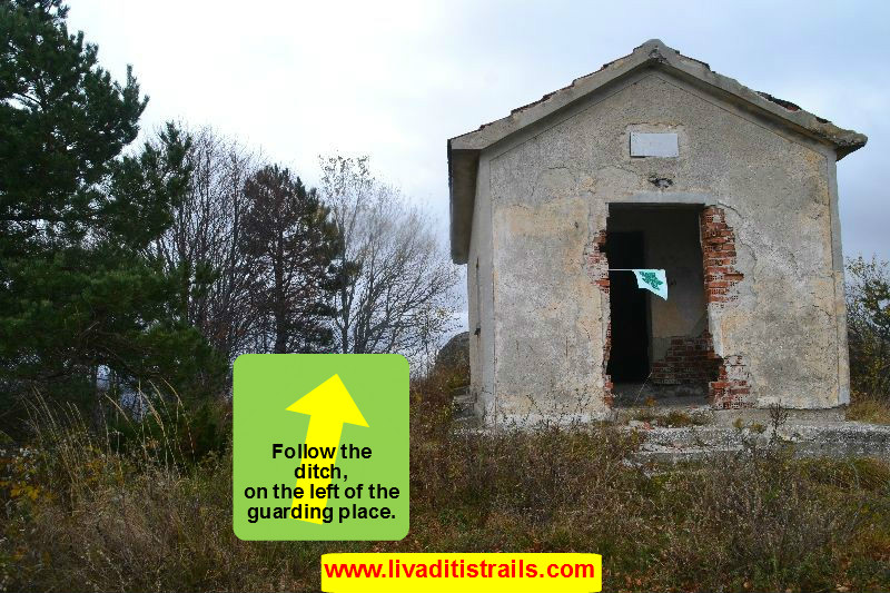 Picture 8.
It needs, especially in the beginning, lots of attention, because of the great downhill slope of the path. In this way and pace you will go down slowly, all the way back to the mountain, which has a length of 1 km and 600 meters. It will take you about half an hour to reach the meeting place of hunters (Picture 9).
 Picture 9.
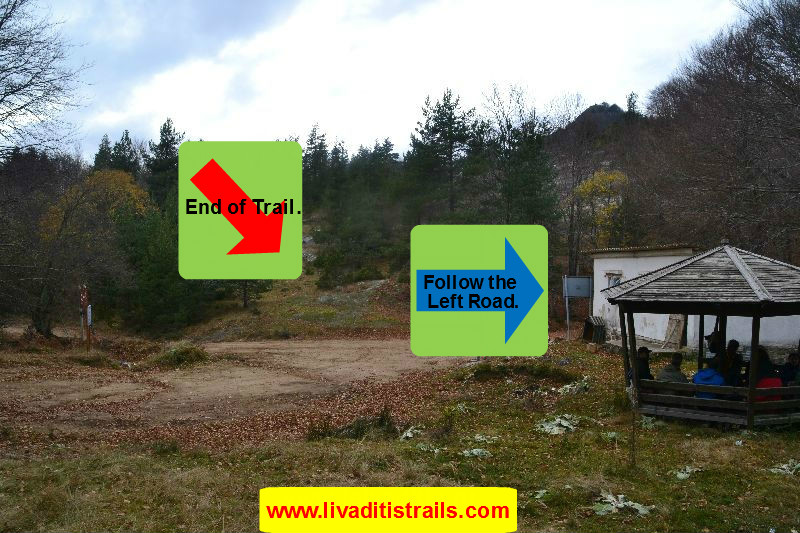
When you get there, you will find out that there is a cluster of roads with a white building and a gazebo on the edge. You need to follow the last left road, which leads to the Forest Village after 2.5 kilometers, ie after 35-40 minutes. This trail is a pleasant route, lasting 2 hours and 30 minutes (that is walking on a country road for 3.5 km and another 4 km on a pleasant path). It is very well signposted and there is no fear of getting lost. As for the view and the beauty that you face from up there it cannot be described in words. Carry with you some coffee, sweat it out a bit more and enjoy your coffee at the best and most beautiful café that is actually... the N A T U R E!!!
The passage of the trail occured on Saturday 30th of November 2013, the same day we gathered all the information that was mentioned, as well as the photographs included in the narrative of the path. We consider ourselves responsible, so we would like to treat those who love Nature and hiking and enjoy learning about new places with the same responsibility. We would also like, if you cross the trail above or any other on our website, to contact us (email: This email address is being protected from spambots. You need JavaScript enabled to view it.) whether we were accurate on our description or there was a flaw that should be corrected.
Thank you for your trust and for visiting our website.